Facts > Geography
Location
Middle East, bordering the Persian Gulf, between Iran and Kuwait
Iraq is bordered by Kuwait, Iran, Turkey,
Syria, Jordan, and Saudi Arabia. The country slopes from mountains over
3,000 meters (10,000 ft.) above sea level along the border with Iran and
Turkey to the remnants of sea-level, reedy marshes in the southeast. Much
of the land is desert or wasteland.
The mountains in the northeast are an
extension of the alpine system that runs eastward from the Balkans into
southern Turkey, northern Iraq, Iran, and Afghanistan, terminating in the
Himalayas.
Average temperatures range from higher than
48 degrees C (120 degrees F) in July and August to below freezing in
January. Most of the rainfall occurs from December through April and
averages between 10 and 18 centimeters (4-7 in.) annually. The mountainous
region of northern Iraq receives appreciably more precipitation than the
central or southern desert region.
Geographic coordinates
00 33 N, 44 00 E
Area
total 438,446 sq km
water 4,910 sq km
land 433,536 sq km
Area - comparative
slightly more than twice the size of Idaho
Land
boundaries
total 3,650 km
border countries Iran 1,458 km, Jordan 181 km, Kuwait 240 km, Saudi
Arabia 814 km, Syria 605 km, Turkey 352 km
Coastline
58 km
Maritime claims
continental shelf not specified
territorial sea 12 NM
Climate
mostly desert; mild to
cool winters with dry, hot, cloudless summers; northern mountainous
regions along Iranian and Turkish borders experience cold winters with
occasionally heavy snows that melt in early spring, sometimes causing
extensive flooding in central and southern Iraq
Terrain
mostly broad plains; reedy marshes along
Iranian border in south with large flooded areas; mountains along borders
with Iran and Turkey
Elevation extremes
lowest point Persian Gulf 0 m
highest point Haji Ibrahim 3,600 m
Natural resources
petroleum, natural gas, phosphates, sulfur
Land use
arable land 11.89%
permanent crops 0.78%
other 87.33% (1998 est.)
Irrigated land
35,250 sq km (1998 est.)
Natural hazards
dust storms, sandstorms, floods
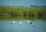
Environment- marshes drainage
Saddam's water control projects have drained most of the inhabited marsh
areas east of An Nasiriyah by drying up or diverting the feeder streams
and rivers; a once sizable population of Marsh Arabs, who inhabited these
areas for thousands of years, has been displaced; furthermore, the
destruction of the natural habitat poses serious threats to the area's
wildlife populations; inadequate supplies of potable water; development of
Tigris-Euphrates Rivers system contingent upon agreements with upstream
riparian Turkey; air and water pollution; soil degradation (salination)
and erosion; desertification.
Environment - international agreements
party to Law of the Sea, Nuclear Test Ban
signed, but not ratified Environmental Modification
Geography - note
strategic location on Shatt al Arab waterway and at the head of the
Persian Gulf